Hiking Trails of Rockland
Rockland Fireworks Trail

The Rockland Fireworks Trail is an extension of the Hanover Fireworks Trail and runs into land in Rockland. This trail loops through the forest and can connect with the French's Stream Trail.
There are additional trails along the way and more past the loop section that can be explored or used as an additional way to access the trail.
The best parking is at Forge Pond Park in Hanover, though there is a small connecting trail on Satucket Road in the Millbrook Dr. area of Rockland off Beech St.
This alternate access trail could be useful in winter when Forge Pond Park is closed and not plowed.

Parking at the first parking area on the
right at Forge Pond Park, cross the
entrance way and follow the hiking
path that leads behind the front
baseball fields.

At .15 the walking trail bends to the
right while the entrance to Clark's Bog
Trail and the Rockland Fireworks Trail
head straight through a gate and into the forest.
The next two lefts will bring you directly
into Clark's Bog.
Shortly on the right will be an access trail good to use if you prefer to park closer than the first parking area.
This closer parking lot is accessed by a road between the first two ball fields on the left of the entrance road.

There will be a Hanover Conservation
sign that says no motorized vehicles,
but bicyclists are welcome and almost
always seen on this trail.

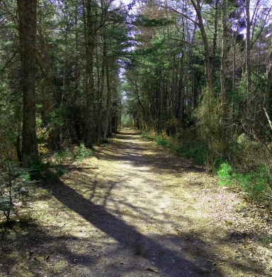
The hiking trail here is wide and
hard packed dirt covered by pine needles.
At .25 another trail leads left alongside
a pleasant brook.
This will lead into the bog area as well.
There will be a couple more lefts along the hiking trail but soon in following them you will be met by a no trespassing sign warning you are entering the Hanover Police firing range.
You can be arrested for trespassing, which would be better than accidently shot at!!

Soon patches of asphalt can be seen through the pine needles.
At .41 miles the Rockland Fireworks Trail will officially begin as you pass through another gate marking the Rockland line.
This is also at an intersection where the end of the loop portion of the trail meets here.
The Hanover conservation disks will continue though.
At the gate another trail will lead off to the left but this is the same as the others, leads to the firing range.

Once through the gate at the intersection
the loop of the Rockland Fireworks Trail goes either way, this guide description
goes straight.
The hiking trail narrows here and much more asphalt appears.
At .47 the trail crossed a stream over a raised culvert.
This raised culvert may be one of the bicyclist attractions as it looks like a mogul.
 There's a side trail that leads to the top of the culvert here.
The water below has a brown tinge but looks very clear!
The trail continues almost a causeway
along an area that looks like it is a
wetland at other times of the year.

At .57 the trail narrows more and the
asphalt starts to break away as the
trail starts some gentle winding.
Shortly after some of the building
remains from the firework/ munition
company that once existed
will appear on both sides of the trail.

Short patches of returning asphalt
grace the trail along with some
sizeable boulders.
At .65 looking through the forest to
left a building more intact than
the rest can be seen.
At .80 the Rockland Fireworks Trail makes it's loop heading to the right as the additional trail connecting to points in Rockland continues straight.

At this loop section you will find
another Hanover Conservation Disk.
This helps the hiker to realize the
formal loop goes this way as the
additional trail is not on the map.
This section of the loop now widens out like the first part of the trail and the asphalt completely disappears.
The forest here has a sparse look to it with the vegetation kept low.
The trail keeps gently turning to the right and soon a wire fence appears to the left but often bent to the ground. Beyond a utility line can be seen several feet past the wire fence.

The trail soon straightens out and at
1.05 miles mounds of earth appear
alongside the trail much like the
underground bunkers found at
Wompatuck State Park.

There is a short trail that leads out
to the power line but our way
continues straight.
At 1.11 the largest building remnant
is trail side and artfully decorated,
unfortunately also been used to dump trash.

The winter brought new damage
to the trail.
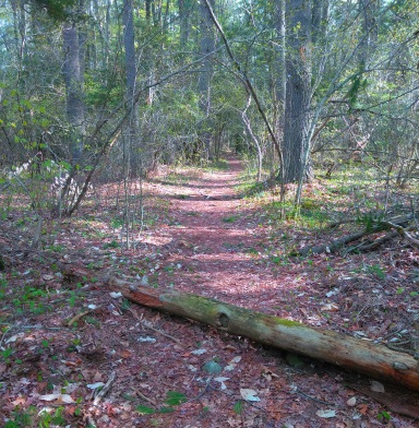
Large pines block the trail
but someone was kind enough
to clear much of the
branches away to make it
possible to pass.
Shortly after another bunker like mound to the right with many fallen trees at the bottom form a perfect party spot for night visitors.
It would be nice if they only picked up after themselves!!

At 1.27 the trail turns to light gravel and a stream runs to the right.
The power line can still be seen to the left.
At 1.36 the trail comes to it's junction.
Going to the right continues the last section of the Rockland Fireworks Trail loop.
To the left is a connecting trail that leads to the French's stream trail making this hike a bit longer if desired.

If finishing the loop, head to the right and the trail continues wide with wetland forming to the left.
It reconnects with the original junction and gate at 1.52
Back out the way you came adds another 1/2 mile and bringing the hike total at 2.02 miles.
Another alternate route to finish this hiking route is to use the access trail to the left near the end of this part of the hiking trail across from Clark's Bog.
It connects to the Forge Park Walking Trail heading to the left and following the walking trail around the edge of the forest and pond.
Additionally, once around you can alternate with the Forge Pond Trail that runs parallel with the walking trail but does so in the forest pond side.
As much as another mile can be added taking this optional route.
Rockland Fireworks Trail through Summer St conservation land

If back at the final trail junction
you have chosen the connecting
trail to the left, this connects to
French's stream trail running
through an area referred to as
the Summer St Conservation Land.
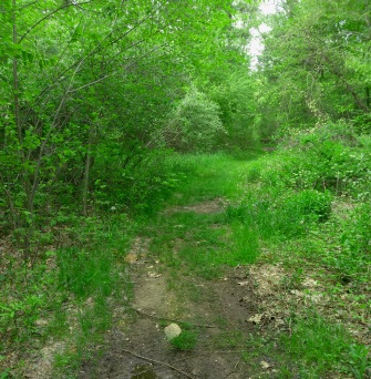
This trail is much more narrow and
not as well maintained.
The Rockland Fireworks Trail goes left as it crosses the utility line. To the right the utility line splits.
On a previous journey I followed the utility line to the right, and soon realized it was wrong.
Once across the utility line continue heading left on it to access the narrow trail that will leave right. In Spring this crossing can be quite wet.
In Summer the trail almost disappears and you will need to look carefully to the right for the remainder of the trail.

This hiking trail at 1.42 miles is narrow
and unmarked but well defined once
into the forest.
This continues straight with several
occasional fallen trees to walk over.
At 1.57 miles the trail gently curves to the right
and continues with some gentle winding.
There will be several downed trees along the way,
some easily stepped over and some a bit more
work to climb over.
At 1.72 large trees fallen with their roots facing
the trail..
Soon the Rockland Fireworks Trail enters the Summer St Conservation Area
at 1.78. Google maps is helpful here!
On the trail map of the area it shows that a future trail
may be developed leading out to Summer St.
At the same point the trail will be marked by a deer hunting
sign. Just after a faint trail leads to the left.
 In spring the trail fills with large pools of water.
The trail will turn gently to the right and straighten out.
Another curve to the right and step over on a downed tree.
At 1.97 a widened area with a large Beech tree.
At 2 miles the trail takes a noticeable curve to the left and meets an older dirt path or water runoff that heads right. The forest has an open look to it ahead.
In spring the trail becomes wet with large areas that create pools on the trail.
Shortly after this turn one of the larger ones appears. Logs have been placed to the left to help with getting around.
There will be more trees to step over and a very slight uphill
At 2.18 a wetland to the left can be seen through the forest.
This wetland is where French's stream flows.
The hiking trail continues it's winding pattern with more trees to climb over.

At 2.23 the sound of water can be heard and the trail curves to the right.
About the same time a stone wall runs to the right.
The trail leads under an arch of vines.
A small trail leads left out to a scenic spot along Frenchs Stream.
Here the water pools a bit and then bottle necks over rocks.
Several large rocks give vantage points for viewing.
Once past the bridge the Drinkwater River enters
the stream ends and the waterway continues as Drinkwater River into Forge Pond.

The Rockland Fireworks Trail
runs across the utility line
on a narrow meadow like trail.
It then meets the Frenchs
Stream Trail at it's bridge.

There is another trail to the
right leading up the utility line.
This can be an alternate route
as it loops and joins the main trail.
Entering the forest at 2.30
the trail now connects with the
Frenchs Stream trail with the bridge
to the left and the trail leading right.
Continue straight on the green arrow trail. This leads to Forge Pond Park.
Looking to the left carefully there is
an alternate route on a red arrow trail.
This is a very narrow bit rugged trail
that runs along the river.
Great for photography, fishing perhaps
and general scenic value.
Many small trails lead out to spots on the river.
Following the green arrow trail the hiking trail widens a bit but is root filled at times.
At 2.35 it turns left on a cart path, it also meets the trail that comes in from the utility line.
Shortly after this turn the red arrow trail enters in from the left.
The trail will soon cross another utility line at 2.51and then Forge pond will come into view to the left

The trail becomes rocky and wet.
Soon the trail crosses a small
bridge at 2.54 over a small stream.
This looks like a rocky water
run off from the park.
A green arrow comes in view
and the trail takes a turn to the left.
At 2.59 the trail passes through a rock wall.
Forge Pond Park now comes into view. At 2.62 arrives at the boat launch area.
From here either use Forge Pond Trail or take a right up the hill for the walking trail to finish the hike to your parking spot.
Using Forge Pond Trail with the Rockland Fireworks Trail and Frenchs Stream Trail will bring this hike just about to 3 mile total.
Using the Satucket Rd entrance to Rockland Fireworks Trail
Santucket Rd is a street deep within the Milbrook Dr. neighborhood off Beech St in Rockland.
Along the road it will turn into a stretch of meadow that catches your eye to the right while the alternate trail entrance to the Rockland Fireworks Trail will be on the left.

Along that meadow section that
separates the two portions of
Satucket Rd there will be a bit of a
guard rail, just before this
on the left you will find some
boulders with the trail between.
The trail starts grassy and
soon leads out to a clearing.
There will be another trail to the
left here but leads to a locked
gate at one of the businesses on
Industrial Way.

A narrow track can be
seen through this clearing.
Stay to the left to find
the continuing trail on
the other side of the
clearing.
Continue straight and the trail enters
the forest at .10 where is soon
looks like the other trails of the
Rockland Fireworks Trail.

Soon patches of asphalt appear
and left over remnants of the
National Fireworks Company.

The forest has an open look to it and to the left you will see vehicles parked at Industrial Way.
At .26 the trail comes to an intersection.
To the left it once again leads to Industrial way to the right leads to the rest of the Rockland Fireworks Trail and Forge Pond Park.

Though in Rockland you will find Hanover conservation blazes.
At .41 a stream comes in from the left, the trail crosses a culvert that allows the stream to pass to the right side of the trail.
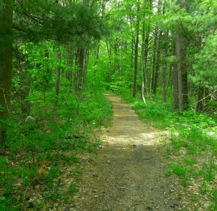
Soon the trail switches from gravel / asphalt to hard packed dirt covered by pine needles.
This part of the trail isn't as well maintained as the main part of the trail but certainly wide enough to hike or bike without vegetation brushing against you.

At 1/2 mile this portion of hiking trail connects with the Rockland Fireworks Trail.
Heading straight will bring you to Forge Pond Park, left continues on the back half of the loop.
return to hiking trails of rockland
south shore hiking trails home page
Recent Articles
-
Eaton Pond Conservation
May 11, 23 12:38 PM
 The Eaton Pond Conservation sitting on the Braintree/ Quincy line is a wonderful hiking area with a varied mix of history and assorted landscape.
 -
Bradford Torrey Sanctuary update
May 09, 23 10:34 PM
Visit the completely updated version of the trail and sanctuary description and it's highlights. The town of Weymouth did a spectacular job of cleaning this gem up with several trailheads established… -
Ellis Estate Trails
Jun 08, 21 11:07 PM
 The Ellis Estate Trails in North Scituate are a collections of trails winding in and around the property they are named after.
Trail
Quick Facts
Directions:
Take exit 32 and head south on route 53. Follow about 5 miles and go right on route 139. Follow this through Hanover Center. Take the third left on Circuit St. Take the fourth left onto School St and then left on King St. Forge Pond Park will only be a few 100 feet on the right.
For Satucket Rd.
Follow the instructions above till Circuit St. Instead of the left on School, continue on to the left on Summer St. Follow till the lighted intersection with Beech St and take a left here. Take the third left on Milbrook Dr. the next left on Morningside Dr, another left on Split BoulderRd and finally a left on Satucket Rd. The trail will be shortly on the left.
Parking:
100's of parking spots
Satucket Rd is street side parking.
Trail time :
Moderate
depending on the route taken,
2-3 miles
Difficulty:
Easy
Water sources:
Forge Pond, French Stream, Drinkwater River and other unnamed streams
Other activities:
Fishing, Kayaking, x-country ski, snow shoe, bicycling the loop and Satucket portion of trail.
New! Comments
Have your say about what you just read! Leave me a comment in the box below.