hiking trails of braintree
Eaton Pond Conservation

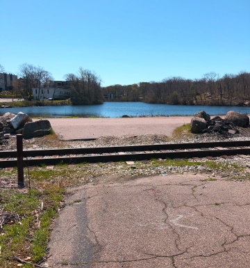 Cross the railroad tracks and head right for the hiking trails at the conservation.
The Eaton Pond Conservation area is in the far northeastern corner of Braintree close to Quincy.
The conservation contains 100 acres of varying landscape including an abandoned quarry, an old apple orchard, Eaton Pond and Hayward Creek. During the early 20th century the pond was used as a source for ice in refrigeration. The kiosk relates that many of the stone foundations found on the property are remnants of the ice houses used for storage.
Tucked away in a neighborhood and not found on Google maps it is of a quieter nature.
Much of this property has an abundance of rock formations great for the budding geologist!
And active children who have a need to climb.
The following guide will take you on a route that will loop through and bring you along each of the trails.
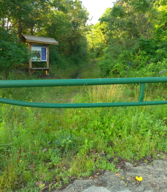
From the parking lot on Bower Rd, cross the railroad tracks (freight only) to Bower Rd ext., a seldom used road, head right.
A short distance away at the pond corner edge a gate where the kiosk stands will appear to the left.
Here the hiking trail starts wide with gravel. Although is summer it can get a bit overgrown.
It runs along the back side of Eaton Pond.
At .12 the red trail connector leads off to the right. No blaze just a no hunting sign here. This trail is where this guide will end.
The wide gravel blue blazed trail continues straight.
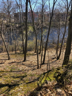 A side trail leads to the lower trail along the pond.
There are many side trails to the left leading to view points on the pond at times rocky ledges.
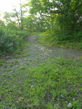 The split on the blue trail. Right brings you directly to the rest of the conservation trails.
Shortly after the red trail connection the blue trail splits on a loop section of the trail. Going left will continue along the pond uphill with more side trails to the pond.
The trail description and mileage lead to the left.
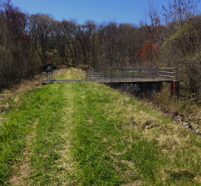
Taking the right is a bit more direct and will bring you quickly to the other trails.
The dam area is scenic and worth a look. Going left at the split brings you directly to the dam area.
In the summer it is filled with wildflowers and at times long grass that gets mown.
At ¼ of a mile you will come to the other side of the loop with the trail leading to the dam straight ahead. There is a platform over the creek leading into the property.
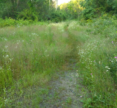 This trail leads to another trail marked by red dots and further one marked by yellow dots.
After an explore of the dam return to the loop end. The trail loop leads left passing a blue dot blaze and left again into a meadow like area.
Entering here a more defined trail leads to the right at .45 marked by red dots. There is a narrow trail leading further into the meadow this is one end of the yellow dot trail but isn't marked on this end.
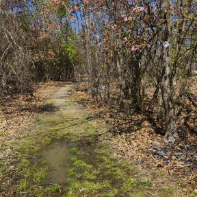 Early spring trail marked by red dots.
The red dot trail is more cart path sized. It runs mostly straight and intersects the yellow loop again at half a mile.
Yellow dot blaze is to the right of this trail on a tree but another no hunting sign is more visible.
Just after this intersection the red dot connector comes in from the right. Continuing straight on the red dot trail the way now runs moderately downhill on a rocky run.
Another intersect at .53. If you continued straight it will lead back out to the Bower Road Ext. which would be a good route on a bicycle.
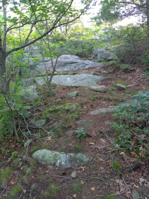 unmarked narrow trail leads over rocky ledges
To the left is the orange dot trail and to the right an unmarked trail leading uphill. Go right here uphill which will lead to a small clearing and an interesting unmarked journey.
There will be many paths leading to scenic overlooks but a narrow path continues through this area over rocky ledges.
Views of the back of Walmart and Bower Rd Ext below. The trail continues over moss covered ledges and another bit of a clearing with a small pine tree.
Carefully pick your way down a rocky ledge area to the far end of the red dot trail. Head left back up the trail to the same intersection at .72.
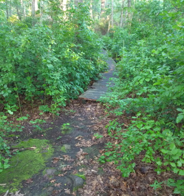
At this same intersect follow the trail now leading right also unmarked but with a no hunting sign, the orange dot trail.
The trail leads on a more narrow track and will soon lead over a boardwalk crossing the Hayward Creek.
The trail will pass by one of the foundations said to have been a storage house for the cut ice.
Shortly after the loop portion of the orange dot trail at.77. Again not well marked, the other loop portion looks only to be a trail leading to the left.
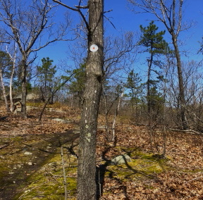
Going right leads up hill to the main quarry area. It runs above on a rocky area with scrub pine and over looks the quarry. There are short trails leading to overlooks into the quarry area. Many recently fallen trees block the area a bit.
It circles to the left and then runs downhill at .92. The orange dot continues left but it connects with a cart path sized trail that runs to the right. If you follow right it will bring you to the bottom of the quarry floor. At the spot of the quarry floor there is a path that continues to the left here as well.
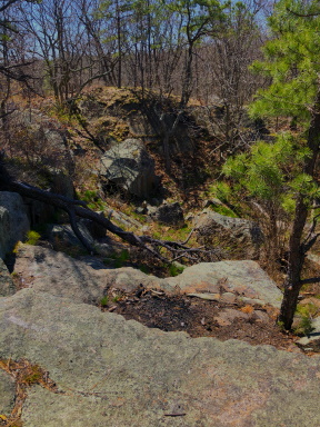
If you look on the map closely there is a bicycle spur path shown but it seems to blend with the orange dot trail but on the map it looks like it was supposed to link on the other side of the quarry.
Its a bit narrow for a bike trail till it gets to this area. If you follow this trail it leads out to the train tracks.
If you now turn around and follow back there is another faint trail now to the right. Another good explore area. It starts faint but becomes more defined and connects to another area that might have been used to quarry as well.
After turning around and heading back to the orange dot trail there is another faint trail not explored to the right. The orange dot trail continues curving slightly to the left and arrives at a “party spot” littered with glass at 1.08.
There is a trail that leads to the right but doesn't go far. The orange dot trail leads to the left of the boulders and back over the boardwalk.
Arriving at the red dot trail once again going right to explore the yellow dot trail now.
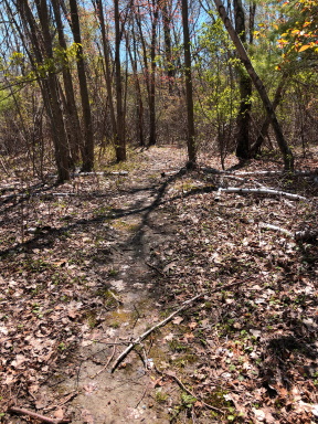
At 1.25 arrived at the yellow dot trail. This is another narrow trail and in leaf season takes on a secret garden feel. Being part of a former Apple Orchard there are many bees early in the warm weather.
The trail runs along a ridge that drops off considerably to the right.
Midway along this trail it comes to what looks like a split but to the right is just a bit of an overlook.
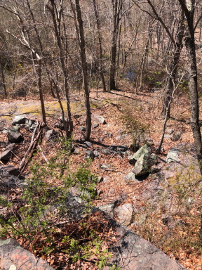 View from the upper yellow dot trail down into the ridge area.
At 1.33 a narrow trail leads off to the right and downhill to the bottom of the ridge. Here the rock formation of the ridge can be viewed as well as what looks like the remains of a vehicle. If one is very adventurous a loop could be made here to climb back up to the ridge portion of the yellow dot trail.
Back up at the yellow dot trail it circles out to what must have been the main orchard section. Not well maintained here but passable running through the meadow area. Now back out at the intersection of the yellow loop the red dot and blue at 1.50 miles.
Went back down red dot trail yet again to the connector portion of the red dot trail to explore.
Short distance down the connector, the trail splits at 1.59. The connector leads straight but a trail leads to the left. This seems to run behind a ridge between the trails. Another close examination on the map shows a double broken black line and no explanation on the map for this trail. Another good explore!!
Continuing straight on the connector the trail descends levels and descends again meeting the blue dot trail at 1.64
Head left on the blue dot to finish the hike arriving back at the parking area at 1.75
Highlights of Eaton Pond Conservation Area
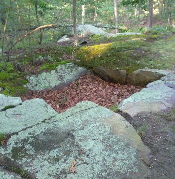 The most prominent ice house foundation remnant found along the orange dot trail
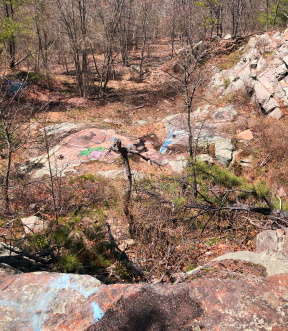 A look out over the quarry
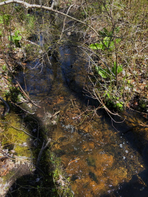 The water in the Hayward Creek looks nice and clear.
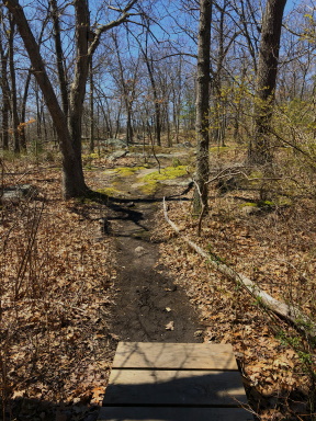 Early Spring full view of trail leading to the quarry area.
Trail
Quick Facts
Directions:
From Exit 40 in Braintree, Union St
From the North follow the rotary all the way around to the 3rd exit of the rotary. If from the south it's the first exit. Immediately on the left take Cleveland St. Continue to the end (it will become Middle St). At the lights with Elm St take a right. At the third intersection take the left onto Howard St. At the next intersection go left on W. Howard St. Just before the major intersection of rt 53 will be Bower Rd. Take this left. You will soon find a large parking area to the left and Eaton Pond will be visible beyond.
Parking:
Large parking area possibly up to 30 cars but not well used.
Trail Time:
Moderate
The guide describes 1.75 miles but there is so much more to explore. 1-4 hours possible
Difficulty:
Easy
Water sources:
Hayward Creek, Eaton Pond
Other activities:
Bird Watching, snow shoeing,
One website suggested this for biking but only the main blue blaze and linking to the red dot although could be difficult in summer is only viable route this way as well as exploring Bower Rd Ext



New! Comments
Have your say about what you just read! Leave me a comment in the box below.