Wompatuck State Park


Wompatuck state park is one of those special places on the south shore.
While this website focuses on hiking trails,
this park features many other opportunities for outdoor activities...
such as bicycling, dog walking, horseback riding, camping, fishing and kayaking.

Wompatuck state park has approximately 70 miles of varying sized trails.
There are many paved roads great for road bicycling or any activity that needs a smooth surface.
Some hard packed sand\gravel mix that accommodate both road and mountain bicycling. These are considered multi use trails. Those looking to do horse back riding are directed to these.
Then there are the many narrow hiking trails that lead off into lesser traveled areas of the park.
Next to consider is the camping, another form of recreation that goes well with hiking!

There are two sides to camping at Wompatuck State Park, one with electricity the other rustic without.
Both sides include picnic tables, restrooms with showers and running potable water.
 Relax by a fire after a day of hiking!
Beyond the campground further down on Union St, is Mount Blue Spring.
The spring has been in use since the 19th century, and many locals consider this to be some of the best spring water to be had.
Its tested monthly and its free! A great place to load up your hydration pack!

There is an area set aside for hunting at Wompatuck State Park!
The Wildlife Management Area is located in the southern portion of the park.
It is accessed on Union St. (the main road) past Mount Blue Spring.
There is no deer hunting in the park, hunting is limited to small game and
waterfowl.
 Aaron Reservoir from the Norwell end.
There are several ponds to fish at.
The largest is Aaron Reservoir or try your luck at the many smaller ponds throughout the park.
Some of the fish that can be caught at the reservoir are bass, pickerel, sunfish, perch and panfish according to an article at the Brockton Enterprise.

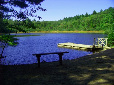
Just beyond and across the road from the campground entrance is a gated park road that runs past the transfer station.
This is an access road to the car top boat launch.
Check in at the Ranger Station at the campground across the street for access to this road.
 Road down to the boat access area
If you want to forgo the check in, and have a hand trailer for your boat, the hike is approx. one mile. There are some hills so hiking with a boat will be a bit strenuous.
It is a pleasant hike with wonderful views at the launch.
 Bring a lunch!
The reward for the one mile hike, with or without the boat!

The new boat ramp makes entering and exiting the water much easier!

The beautiful and interesting to kayak Aaron reservoir was created in the years 1976-1978.
The water surface is 133 acres.
A 900 foot dam was created across the Aaron River to create the reservoir giving the town of Cohasset a backup water supply which came in handy during the drought of 2016.
A trip to Cohasset to explore the dam is well worth the effort. Although if you are in the park you can use the map to navigate to the marker R9 and the trails around the reservoir which will bring you to the parking area at the dam. A walkway exits on top of the dam.
 Union St beyond Mount Blue Spring
Wompatuck State Park spans over 3500 acres with it's address in Hingham, but its borders reach into the towns of Cohasset, Scituate and Norwell.
The main road through the park is Union St. It ends at a gate in Norwell at the end of Mount Blue St.
Park History:
Wompatuck State Park takes its name after the Indian Chief Josiah Wompatuck who deeded the land to the English settlers in 1655. The Braintree Historical Society has an interesting page on Josiah Wompatuck, be sure to check out the pdf link below the information on the page.
Most of the history of the land was residential till 1941-1965 when it housed the Hingham Naval Ammunition Depot Annex, some just called it the Cohasset Annex.
Unfortunately much of the land acquired was seized by imminent domain due to the 2nd world war and the need to produce and store munitions. The location of this annex and the use of extensive network of rail lines to transport the munitions to the shipyards made this a convenient location.
It opened as a state park in 1969 and was dedicated in 1973.
The friends of Wompatuck have a more detailed history of the park and more great information as well!
There remain several areas in the park closed to the public because of safety concerns due to the need to remove the last effects of the munitions site.
Many of the bunkers remain today. Some filled in, but very obvious others open for viewing.

One of these areas was an old railroad spur line that for many years was closed due to safety concerns. This spur was the prime way for materials to be transported to railroad lines during WWII.
Extensive work has been done to clean this up and a new bike path was created in 2015 to connect the park to the Cohasset MBTA station. The Whitney Spur Rail Trail is a wonderful addition and connector to the park.
This makes it possible for anyone coming from Boston or Plymouth to arrive on foot or bicycle.
 A very inviting bike trail into Wompatuck State Park and Whitney Woods.
More features of Wompatuck State Park

Bicycling is big at Wompatuck State Park. There is rarely a day that goes by without someone in the park on a bicycle.
The park has taken that into consideration by supplying this bicycle repair station.
Located in the parking area of the visitor center, this station has all the tools needed.

Another park feature geared toward the bicyclists, this one younger bicyclists is the pump track.
A fenced in course designed to challenge a younger or less experienced cyclist on off road trails.
Some light hill work is included. A great way to get kids involved in a life time sport!
Hiking Trails at Wompatuck State Park
There are almost endless opportunities and options for hiking trails in Wompatuck State Park, but I will list a few of my favorites.
If you are camping at the park, these first two are very convenient to that activity.
Scenic pond with a trail that connects the campground to the wildlife management loop and beyond.

A scenic loop trail that is named after the pond it passes by. The trail climbs Mt Hope in Scituate and loops down to a spot on the far end of Aaron Reservoir.
hiking trails near the entrance
Visitor Center Loop

The historic hiking area of Triphammer Pond has been on the website for some time now but is accessible at the very front of Wompatuck State Park.
Always scenic and blends well into the trails of the park.
The Alternate Entrances of Wompatuck State Park
There are many entrances to Wompatuck State Park outside of the park.

These alternate entrances are useful in certain circumstances.
The winter season is one such occasion. Once Columbus Day weekend has concluded the park goes into "winter" hours.
The main two parking areas are accessible all yearlong but the yellow gate just beyond the visitor parking closes at 3:30.
In true winter this is a reasonable time but in early fall or late spring it is a bit early.
If you are hiking a more remote area of the park, these alternate entrances get you closer to your destination without time constraints.
If there is snow on the ground these entrances may be cleared sooner than the park lots. Important if you love to get on the trail when there is fresh snow!

South Pleasant St Entrance:
This entrance is in Hingham not far from the main entrance. If you follow the directions to get to the park, South Pleasant is a right off route 228 before the lights at Free St. Follow to the end, it crosses Charles St first.
There is not much parking here. Only 2-3 spaces at the end of the street.

This is the closest entrance to the campground.
Heading straight "South Pleasant" continues as a trail and will meet the main road of Union St in the park.
There is a multi use hiking trail that runs to the left that can be used to bring you to the front of the park.

Mount Blue St. Entrance:
This is the back gate at the end Union St in Wompatuck. Mount Blue St is in Norwell.
If you follow the directions to Wompatuck, when you reach the lights at route 53 take a right. At the next set of lights take a left onto Grove St. Follow for approx. 2 miles going straight through the stop sign at Prospect St. Take a left on School St which is on the bend in the street. Follow School St to the end and take a left on Mount Blue St.
There is a bit more parking at this entrance but only to the side of the street.
This is close to the Picture Pond Loop and the southern trails directly across from the loop trail. Holly Pond is a short distance from here.

Leavitt St Entrance:
This entrance is also in Hingham. It is a more northern entrance.
If following the directions for the main entrance go straight at the lights at Free St and continue on route 228.
 Plenty of parking at the Leavitt St entrance!
This route will take a deep right at the intersection with Central and Cedar Sts and take a couple lesser bends becoming Leavitt St.
Leavitt St leaves route 228 at the Hingham Public Library. Follow this to its end.
 Great place to start a bicycle tour of the park.
This entrance is close to Turkey Hill. Along the way to the entrance to Wompatuck there will be a trail leaving Leavitt St. This will take you to Whitney and Thayer Woods.
The Leavitt St entrance is convenient to visiting that area as well.

Dolan St Entrance:
This entrance is in Cohasset. It is reached by continuing on route 228 till you come to the lighted intersection with Route 3A.
Take a right and follow to the fourth set of lights at Beechwood St. Take a right on Beechwood and follow till its intersection with Doane St.
Take a right and follow to the end.

This entrance is the north east version of the Leavitt St entrance.
If followed straight across the park, it will connect to Leavitt St.
It runs along the border with Whitney and Thayer Woods.
Another wide street entrance to start a bicycle ride through the park.
 Another entrance with plenty of parking!
Aaron Reservoir parking and entrance:
Aaron Reservoir entrance is close to the Dolan St entrance. Following the directions to Dolan St, instead of turning right on Dolan continue to the end of Beechwood St.

This brings you to a parking area with the entrance to the right.
You may not notice the entrance as the man made dam of the Aaron Reservoir will be directly in front of you and much more impressive!
Follow through the gate and up the trail to the top of the dam.
 The view will not disappoint!
Once done with exploring the top of the reservoir, if you have left yourself with some time you can enter the trails at the entrance below.
Looking at the map you will see trail markers that begin with an "R" on this side.
Most likely this "R" stands for reservoir.
These wind in and around the edges of the very irregular reservoir.
- South Shore Hiking Trails ›
- Wompatuck State Park
Recent Articles
-
Eaton Pond Conservation
May 11, 23 12:38 PM
 The Eaton Pond Conservation sitting on the Braintree/ Quincy line is a wonderful hiking area with a varied mix of history and assorted landscape.
 -
Bradford Torrey Sanctuary update
May 09, 23 10:34 PM
Visit the completely updated version of the trail and sanctuary description and it's highlights. The town of Weymouth did a spectacular job of cleaning this gem up with several trailheads established… -
Ellis Estate Trails
Jun 08, 21 11:07 PM
 The Ellis Estate Trails in North Scituate are a collections of trails winding in and around the property they are named after.
Trail
Quick Facts
Directions:
From route 3 take exit 35 heading north on route 228. Continue straight through lights at route 53 continuing on route 228. There will be signs for Wompatuck State Park along the way. Take a right on Free St. at the lights. The road will take a deep turn to the left and the State Park will be on the right.
Parking:
2 large parking lots at the front of the park and many other spots closer to trails along Union St.
Trail time:
Light to extensive depending on hiking options or trails
Difficulty:
Mostly Easy
trails well defined most hills are light
Water sources:
Mount Blue Spring, Aaron Reservoir, Aaron river, many other streams and smaller bodies of water.
Other activities:
Bicycling, Horseback riding, Fishing, Car top boating, Camping, picnicking, xc skiing, snow shoeing, small game and water fowl hunting

Using the Maprika app is highly suggested.
Together with your smart phone the app acts like a GPS showing you what trail you are hiking down. Great for this park with its vast network of trails!
New! Comments
Have your say about what you just read! Leave me a comment in the box below.