hiking trails of Weymouth
Webb Memorial State Park

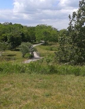
The hiking trails at Webb Memorial State Park are a great summer destination as they offer great views of Boston Harbor as well as being open and generally bug free.
The hiking here is comprised mostly of a series of looping trails.
Along the way are memorials to Weymouth citizens that have made a difference in the community.
Being a park and not just a conservation area, this destination offers plenty of parking, trash barrels, picnic tables, benches, a water bubbler (great for dogs as well as humans) and rest rooms.
This park is maintained by the DCR (Dept. of Conservation and Recreation).
Another feature of Webb Memorial State Park is the rocky beach along most of the edges of the peninsula this park sits on.
Great for sitting and sunning or a good launch site for kayaks.
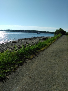
From the parking lot and heading straight up the wide gravel based road named Robert Ambler Way, the hiking trail climbs gently and becomes a more moderate incline.

It soon leads into lush vegetation
and arrives at a fork at .16.
The vegetation opens up here to the
right with mown lawns and a view of Grape Island.
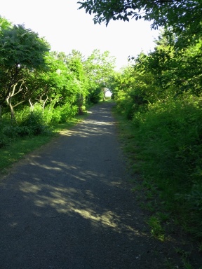
At the fork going left will take you through
full vegetation heavy with bird activity.
Along the way there are roses to the left
and mown grass side trails to the right.
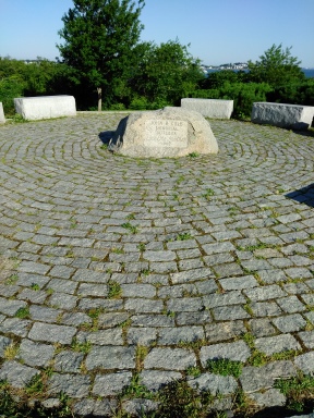
At .28 the hiking trail leads to the right and there is a narrow trail going to the left.
In between is the John Cole Memorial on a bit of a hill with views of the harbor beyond.
My visit here was on a perfect summer day, not too hot and breezy.
After reading about John Cole take the narrow trail leading left. This circles the memorial a bit downhill and rejoins the main trail at .38.
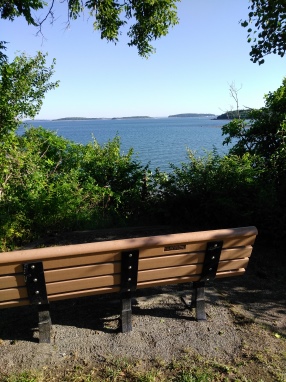
Going to the left here brings you back into vegetation.
The vegetation here at Webb Memorial State Park is much like the vegetation on the harbor islands.
Dotted with a few large trees but mostly shorter ones like the antler sumac tree also known as staghorn sumac.
Shortly after returning to the main trail there will be some benches where the view opens up again.
Here Peddocks Island is straight ahead and Grape Island is to the right.
 Webb Memorial is the perfect place for a picnic!
The trail has become sandy and at just
before 1/2 mile comes to a picnic area.
Shortly after the hiking trail intersects
with a connector trail.
Taking a right the trail becomes gravel pavement.
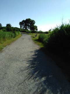
At .54 tall grasses form along the right
and more harbor views to the left.
The hiking trail soon comes to a
large lawn area dotted with benches.
Another connector trail will lead
you back to the parking area.
Heading straight and to the left will lead you on a loop trail on the lower end of the peninsula.
There is also a sandy side trail to the left leading to a polished rock beach. A bit of a beach explore added to the mileage of this hike.
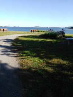
At .70 back from the beach heading left.
A few steps later at the loop intersect
and going left for the peninsula loop.
Shortly down this trail is another narrow trail
leading down to the same beach.
At .81 the trail comes to a lawn area and more views. Now the Fore River Bridge comes into sight.
At .85 can see the return portion of the trail to the left and another memorial.
At .88 we reach the tip of the peninsula. Here you can see most of Boston Harbor, Hough's Neck in Quincy and very close view of Grape Island.
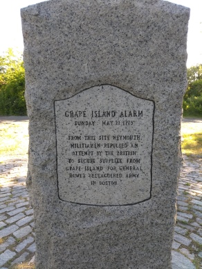
As we round the peninsula and start on
the return, at .95 there is a memorial
to the Grape Island Alarm.
There will be a short grove of vegetation
and then the beach opens to the left.
Quite often you will be watching the ferry
from Hewitt's Cove running through this area.
To the right is another mown lawn trail. These can extend the hike considerably and are great for bird watching.
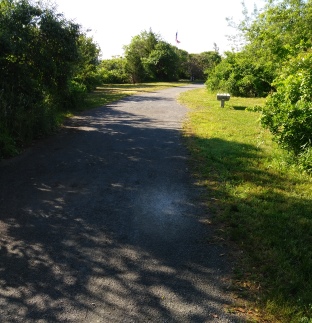 Approaching the Donald F. Haviland Memorial with a flag.
At 1.09 the trail reaches the Donald Haviland
Memorial with a flag.
There will be yet another small
trail down to the beach area.
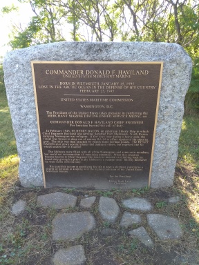
A few steps later we arrive back at the loop intersect and heading straight leads along the Hingham harbor area.
Across the water from the Webb Memorial State Park is Hingham and the Bouve Conservation Area.
At 1.21 there are more lawn trails to the right. Shortly after a bench and trail to the beach on the left.
A few more steps and there will be a wide entryway to the beach, great for getting a kayak to the water.
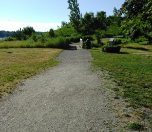
At 1.33 is a fork, right takes you back
to the parking area, going left you can
continue on the journey.
Along this stretch to the left will be a
picnic table at the beach and the
rest rooms will be on the right.
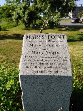
The trail will lead over a small bridge
bringing you to Mary's Point.
Now the hiking trail will lead uphill
moderately and more roses in
bloom sweeten the air.
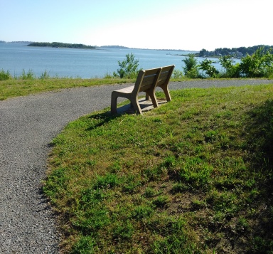
At 1.44 there will be a sharp left,
while straight leads into DCR
maintenance area and additional parking.
At 1.48 the trail curves to the right with
benches and views of the end of Hull
and the lighthouse beyond on an island.
The trail continues uphill and turns to the right with views of Hingham shopping area and the ferry wharf.
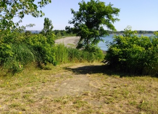
At 1.53 the top of the point or hill with more benches and picnic tables.
The trail can be continued by either turning around or following a steep little informal sandy trail down the hill straight ahead.
Retracing our steps the bridge comes in at 1.66 and the rest rooms at 1.70
The Memorials at Webb Memorial State Park
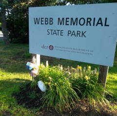
One aspect this website likes to cover when possible is any history of an area covered. The memorials in this are a big part of Webb Memorial State Park.
Prior to becoming the park it is today, the peninsula was part of the Bradley Fertilizer Factory and unfortunately was used to dump industrial waste in the late 1800's.
Later in the 1950's it housed missiles for the Nike missile project which helped create this country's first operational anti-aircraft missile system.
The site was deactivated in 1974 and transferred to the Commonwealth of Mass. in 1977.
It opened as the Webb Memorial State Park in 1980.
It is now part of the Boston Harbor Island Parks and the only land based part of that park system.
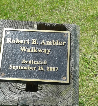
The park itself is named after a Weymouth police officer and WWII veteran William K Webb with state documents referencing him as a Captain.
The main walkway around the peninsula is named the Robert B. Ambler Way.
Named after a Town of Weymouth Selectman who had been noted for his long term service and dedication to the town.
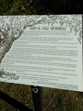
Walking the hiking trails in the order of the trail guide suggested for this park, what is the largest memorial is the Cole Memorial.
Named after a man named John H. Cole originally from South Boston who made his home in Weymouth for 25-30 years.
He worked for the MBTA and must of been quite the remarkable man as a long description is etched on a stone tablet relating the kind of man he was.
The memorial is dated 1980, the year the park was opened.
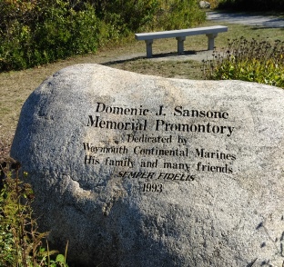
At the far end of the peninsula is the Domenic Sansone Memorial.
A Weymouth continental Marine with a 1993 date on the memorial.
Behind the Sansone Memorial is the Grape Island Alarm memorial. It looks much like the Cole Memorial but not as extensive.
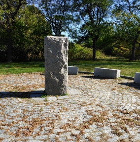
Grape Island was the site of a revolutionary battle and some refer to it as the Grape Island Straw Alarm.
In 1775 the island was home to a private farm owned by a Elisha Leavitt who was a loyalist.
Loyal to the British troops. As their supplies ran low, they came to the island to secure hay for their horses.
The Patriots watched from the shore but were unable to retaliate till the tide came in and were able to launch their boats.
When they did arrive they forced the British Troops off the island and burned both the hay and the barn that housed it to the ground.
More interesting info can be found here... Boston harbor beacon
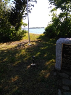 The Haviland Memorial with a beach access trail.
Continuing on is another interesting memorial at Webb Memorial State Park to Donald F. Haviland.
Born in Weymouth in 1895, he became a merchant marine.
He was lost at sea in the Artic Ocean in Feb.1945 while defending the country.
He was the acting Chief Engineer aboard the SS Henry Bacon, transporting Norwegian refugees out of Russia.
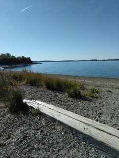 Beautiful beach and harbor view from the Haviland Memorial.
The ship was forced to drop out of a convoy it was part of to repair the ship.
During the repair stop they were attacked by German planes. The German's were able to deliver a hit that damaged the vessel.
With all the refugees aboard there were not enough lifeboats for all. Once hearing this Chief Engineer Haviland climbed back on board giving his seat to a younger man.
He went down with his ship!
He received the Distinguished Service Medal for heroism above and beyond the call of duty.
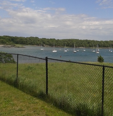 The view from Mary's Point.
Continuing on to Mary's Point, the memorial for the two Marys for which it was named after.
Mary Toomey and Mary Sears for their years of service and commitment toward the Back River and it's estuary.
It is notable that Mary's Point sits on it own hill which is a classic example of a drumlin. Geology of the area states that the peninsula is a series of three connected drumlins.
Drumlins are glacial creations and many times cluster into a field of drumlins.
They are small elongated hills, one end with higher elevation almost like a cliff and a sweeping end that meets the ground.
If anyone has any personal insight or stories of the people listed above, please do share below.
- South Shore Hiking Trails ›
- Weymouth ›
- Webb Memorial State Park
Trail
Quick Facts
Directions:
From route 3 take exit 38 and head north on route 18. At the second set of lights route 18 ends. Go left on route 53. (Washington St).,Follow til the 2nd set of lights and take a right on Commercial St. Follow approx. 2 miles and take the left on Church St. At the next set of lights take a left and then quick right on Green St., Follow up to route 3A and go straight across onto Neck St. Neck St will take a turn and the road will become River St. Follow to the end for Webb Memorial.
Parking:
Trail Time:
Light to Moderate
Difficulty:
EasyWater sources:
water fountainOther activities:
Kayaking, birdwatching, Cross country skiing, snowshoeing, fishing, group activities at the pavilion


New! Comments
Have your say about what you just read! Leave me a comment in the box below.