hiking trails of duxbury
south river bogs trail


The hiking trails at the south river bogs are a hidden gem that most likely only the local know where to find.
The main entrance is on North St.
If heading east on this road you will most certainly drive by the entrance.

Even heading north a careful look to the left is a must. Here there is only room to park one vehicle off road.
Others will be left to park at the side of a somewhat narrow forested road.

The hiking trail starts off wide and a bit grassy.
Soon there is a moderate downward grade the trail turns to a sand and pine needle mix.
There is evidence that there is regular water runoff here as the trail becomes a bit rutted and rocky.
The trail evens off and at about 1/4 mile another trail leads to the left.
The hiking trail makes it's way through a bit more forest and then comes upon a
junction and opens out to the bogs with the South River flowing through it.
At the river crossing the trail leads over by a cement bridge. On the other side another trail intersection and the trail leading straight goes into the forest on the other side of the bogs.

This ends out on Duxborough Trail to the side of the driveway of number 73.
There is a gravel patch lined by thin wood that looks to be a parking spot that is grown over with weeds.

Turning around and coming back to the bogs
and taking a right will follow along the
southern side of the bogs.

The trails on this end become much more narrow.
Most of the trails through the conservation area circle around the bog. There are bridges on either ends crossing the South River.
Once to the end of the southern border trail another trail leads away into the forest.
This one ends in the neighborhood of the street named South River Trail. It ends at the side of some private property.

Back into the bogs the trail leads over the second bridge.
The hiking trail then leads to another corner where a wide trail leads to the left taking you back to the original intersection at the bog edge.
Along the side of this trail there was a dry river bed opposite the bog.
Many blueberry bushes can be found here as well as other bushes supporting berries.
At this same far corner a trail heads straight. This leads back to the trail that lead left as you head down the main trail at the beginning of the hike.

This passes by many blueberry bushes as well.
Though there are 106 acres to the south river bog trail property (the trail sign says 100 town docs say more) the trails do not seem to use much of the area.
Total mileage was just past one mile.
In the fall it is a must to wear hunter orange. This property is designated as one that hunters can obtain a permit to use.
Though the law states that hunting cannot take place within 150 feet of marked trails safer than sorry is always the best choice!

Some of the better views
are from the lower bridge
at the far end of
the property.
Notice the turtle at the
bottom of the picture.

Here's a closer view of that!
- South Shore Hiking Trails ›
- Duxbury ›
- South River Bogs
Recent Articles
-
Eaton Pond Conservation
May 11, 23 12:38 PM
 The Eaton Pond Conservation sitting on the Braintree/ Quincy line is a wonderful hiking area with a varied mix of history and assorted landscape.
 -
Bradford Torrey Sanctuary update
May 09, 23 10:34 PM
Visit the completely updated version of the trail and sanctuary description and it's highlights. The town of Weymouth did a spectacular job of cleaning this gem up with several trailheads established… -
Ellis Estate Trails
Jun 08, 21 11:07 PM
 The Ellis Estate Trails in North Scituate are a collections of trails winding in and around the property they are named after.
Trail
Quick Facts
Directions: Take exit 27 on Route 3 heading East on route 139. Follow into Marshfield and continue heading east through 3 lighted intersections. After the intersection with furnace st continue one more mile for Cross St. on the right. At the next intersection take a right on Old Ocean St. At the fork in the road continue straight on Mt. Skirgo St. this will become North St upon entering Duxbury.
The trail head will be shortly on the left.
Parking:
one vehicle only at side
Trail Time:
Light only about a mile of trail.
Difficulty:
Easy
Water sources:
south river
Other activities:
bird watching, snow shoeing,
cautions: heavy mosquito activity as with any forested wet area in season.
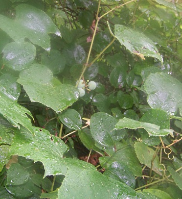
grape picking in aug and sept.
blueberries in july and aug.
New! Comments
Have your say about what you just read! Leave me a comment in the box below.