hiking trails of duxbury
camp wing conservation area


The hiking trails at camp wing conservation area
in Duxbury on Franklin St are an interesting
assortment of loops attached by adjoining trails.

This area features the John Sherman Path,
an observation deck next to a marsh,
and a cable seat used to get across a stream
instead of a the usual bridge!
This portion of camp wing trails are on Franklin St with parking by the side of the road.
The hiking trail starts wide and gravel bound. The John Sherman Path leaves immediately to the left. The first part of this trail is marked by blue rectangles.
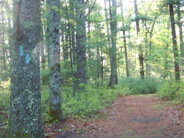
At only 1/10 mile the blue rectangle trail goes to the right and blends with the first loop marked by red rectangles.
This is confusing at first, but this area is not that large.
Not long after wandering through these trails one will soon realize the area is comprised of two loops joined by the blue rectangle trail.
Another confusing point is that on the second
part of this blue trail, the markers turn green
and the red turn a bit more orange.
(Ran out of the right color paint? Or is this
to signify you are on the second part of these hiking trails?)

At 1/3 mile the blue, that switches to blue/green narrows to cart path sized trail. At 1/2 mile it passes over a low wide bridge over a stream. Shortly after, on the left, one of the narrow access trails to the John Sherman path lead off.
At 6/10 mile a trail leads to the right that is posted as closed. This trail leads to private property of which is not posted as closed on the other end. This other end is found on another part of the Camp Wing trail, so you may find yourself hiking this "closed trail" anyway. It travels in a sharp horseshoe shape.
At almost 7/10 mile the second loop with it's red/orange rectangle intersects. Here I went right with a light downhill grade. Soon after, the end of the John Sherman Path will come into view and a few steps more an unmarked trail leads to the right. This is the beginning of the closed trail that leads onto the private property.
Highlights of these hiking trails!

On some portions of the hike you will find the more descriptive blazes that are blocks of wood with wings carved into them! There are no official signs that mark this area as part of the Camp Wing Conservation Area, this is a nicer way to label them.
At 1.14 miles the white rectangles of the John Sherman Path can be found intersecting the conservation trail. Signs pointing to the observation post will be found at this intersection as well.


Here you will find a good sized platform with seating. A wonderful resting spot!
The trail continues here narrowing and lined by high bush blueberry bushes!
The bushes break in several places and views of the bog open up. Some very high roots are along the trail here.

At 1.26 the trail comes to a stream (another portion of the Phillip's Brook emptying into a bog). You will not find a bridge to cross over to the remaining hiking trail, what you will find is a chair that crosses the stream by way of a cable.
As I stopped and contemplated the best way to use this device, I watched a young beaver cross the trail on the other side of the stream.

A good ride across the stream,
but not too long!

Checking how sturdy the ride
across will be important!
There is a good sturdy cable
supporting the chair at the
top.

Lots of rope for navigation.


Plenty of secure hardware.

The trail continues along the bog.

Once across, the trail follows shortly
to the other end of the bog.
It then ends in a somewhat cleared
forest area beside route 3.

Looked like a good camping spot
but the traffic on route 3 would
certainly wake you up early!!
 Another trail highlight: lady slipper
- South Shore Hiking Trails ›
- Duxbury ›
- Camp Wing
Recent Articles
-
Eaton Pond Conservation
May 11, 23 12:38 PM
 The Eaton Pond Conservation sitting on the Braintree/ Quincy line is a wonderful hiking area with a varied mix of history and assorted landscape.
 -
Bradford Torrey Sanctuary update
May 09, 23 10:34 PM
Visit the completely updated version of the trail and sanctuary description and it's highlights. The town of Weymouth did a spectacular job of cleaning this gem up with several trailheads established… -
Ellis Estate Trails
Jun 08, 21 11:07 PM
 The Ellis Estate Trails in North Scituate are a collections of trails winding in and around the property they are named after.
Trail
Quick Facts
Directions:
exit
11 on route 3 heading west on route 14. Approx. 1 mile take a right on
Franklin St. Road turnoff/parking area is about 1/2 to 3/4 miles on the
left.
Parking:
approx. 4 vehicles
Trail Time:
light to moderate: 1-2 hours
Difficulty:
Easy
Water sources:
Phillip's Brook
Other activities:
Birdwatching, snowshoeing, light bicycling or cross country skiing,

New! Comments
Have your say about what you just read! Leave me a comment in the box below.