hiking trails of Duxbury
Lansing Bennett Forest


The Lansing Bennett Forest on Union
Bridge St in Duxbury,
originally known as Trout Farm
Conservation was renamed after
Dr. Lansing Bennett
Chair of the Duxbury Conservation Commission.
He served in the years of 1967 to 1979 and diligently worked to create a greenbelt plan of conservation land along the river watersheds thoughout the town.
During his time on the commission he helped secure over 1,200 acres of land.
The 344 acres of the Lansing Bennett Forest are said to be one of the more satisfying acquisitions he made, so it was fitting that it was renamed after this dedicated servant.
More History of Lansing Bennett Forest

The Lansing Bennett Forest was purchased by the town of Duxbury in 1970 from the Lot Phillips Company.
Formerly of Hanover, they manufactured wooden boxes.
The earlier reference to Trout Farm comes from the Phillips Brook.
This brook runs through the property and is a tributary of the South River which was known to be full of Trout.
Phillips Brook was used as a Trout Farm. A recent study from the Division of Fisheries and Wildlife found that some wild brook and brown trout still exist.
Along the trail you will also come upon the remains of Howland's Mill.
Noted as the last mill in Duxbury, built in 1830 right along the bank of the Phillips Brook. It started as a grist mill but switched to a saw mill.
Lansing Bennett Forest Hiking Trail

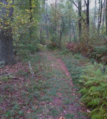
From the parking lot on Union Bridge Rd. the wide trail in leads downhill gently.
It soon curves to the right along a pine needle laden trail that is interrupted by many tree roots.
It runs through a stand of baby pine trees and in early fall after some rainfall there are a significant amount of mushrooms along the way.

It curves again to the right still leading downhill till it levels at .15 whereby patches of sand peek through the pine needles reminding you that this is a coastal town.
At .18 there is a fork in the hiking trail. Yellow blaze to the right and red blaze to the left.
I follow left for a full forest explore, the trail soon narrows to a true path.
The red blazes continue, some a bit faded but the path is well defined.
At .23 there will be a bit of an incline and more curving to the right. The forest is wonderfully quiet with only a faint sound of traffic in the distance.
At .34 the red blazed trail meets the blue blazed trail. No markings as such, only the map to guide me here. Going right here can lead you on a shortened loop trail.
I go left to fully experience the Lansing Bennett Forest.

The hiking trail continues as a path yet wide enough to not touch vegetation as some appreciate.
Continuing on, still no blazes till the next intersect.
Now the blaze indicates a turn to the right, yet both ways are blue blazed.
To the left the hiking trail leads out to Cross St. a separate way into the forest which may be useful in the winter.
Going left at this intersection, because I like to explore the whole forest, this portion of the hiking trail narrows even more so.
You will brush against vegetation on this leg of the journey.

At 1/2 mile you will reach Cross St. Looking left down the street you will see Derenzo Dr.
Turning around to go back into the Lansing Bennett Forest you will notice the sign alerting you to the trail entrance. This sign is a bit set back, not noticeable and does not receive much attention.
Heading back to the intersection and then turning left to continue on. This portion of the hiking trail continues as narrow as it did before with a hill forming alongside to the left of the trail.
At .70 you will notice faint trails leading up the hill, resist the temptation to follow them unless you want or need some strength training.
The blue blazed trail will now start to climb this hill on a more moderate track.
It ascends the fairly steep hill in a switch back manner. If you don't know the term, it is a trail that zigzags up a steep area instead of taking the way straight up.
Much easier on the joints!

Along the way up faint direct trails continue to cut through.
At .76 miles the trail is almost to the top but the reflex to turn around and take a picture of the hill side takes over!
At the top the hiking trail widens out and the familiar white rectangle that marks the Bay Circuit Trail can be found.
Soon the trail will curve to the left and runs through an area of fallen trees that have been removed.
At .87 is another trail intersect but this one is partially blocked. Most likely the trail that leads to private property shown on the Lansing Bennett Forest map.
 A very steep trail leading down alongside a pond just barely seen through the trees.
Another intersect to the right if followed appears to lead toward a pond downhill but will quickly fade.
Continuing on more BCT blazes will be seen along the way.
At .94 the trail sits atop a steep hill with a trail leading straight down on the right leading down to the pond's edge.
The hiking trail now runs moderately to almost steeply downhill and arrives pond side at 1.05.
At 1.10 we arrive at the side of route 53 across from a store.
If you travel through the parking lot of this store to the forest edge, a trail will lead into Thaddeus Chandler Sanctuary.
The official route of the BCT goes across the street and takes a left leading along a guard rail and shortly after another trail on the right will bring you into the sanctuary.
Now I turn around and travel back the way I came. Up hill where conveniently located tree roots form a system of steps that make travel up this steep hill much easier.
- 1.31 the intersect with the private trail
- 1.39 top of the switchback
- 151 the intersect with the Cross St Entrance.
- 1.56 the intersect with the Red blazed trail.
Going left here the trail is still a blue blazed trail but the blazes are predominantly marked by BCT blaze of white.

The trail is narrow again and winding but interesting with a slight downhill tendency.
At 1.63 there is a step down and over a dry creek bed. It then runs uphill. At 1.69 an animal trail runs to the right.
The trail continues uphill gently, turns left but a short trail on right runs to a view of a depression downhill.
The brochure about the Lansing Bennett Forest available at the kiosk speaks of many kettle holes formed by glacial ice that melted. No doubt this is one.

The trail now runs downhill at first
gently then a more short steep section
but again tree roots act as steps.
At the bottom the trail runs over a
stream which becomes obvious that
it is Phillips Brook.
It crosses over by a small bridge.
The trail turns right widening to a cart path with a steep bike trail to the right.

At 1.80 another intersect with the
main trail running to the right but
to the left a rough looking wide trail.
Most likely one of the blue blazed
trails that run out to Franklin St.
Heading right the trail is narrow and grassy and runs alongside the bubbling, shallow and sandy bottomed brook.

At 1.88 a sign on the left points to King Phillips Spring.
This looks like a dark murky hole,
the brook to the right looks much
more inviting as it is absolutely sparkling clear!
 In mid fall Phillips Brook is very shallow but crystal clear!
The hiking trail continues narrow
and lush with vegetation.
It continues to follow Phillips
Brook with many views of the brook.

At 1.93 miles a green blazed trail runs off to the left. Another Franklin St exit.
At 2.01 miles the start of some boardwalk planking.
Skeeter bugs (which probably have a more correct name that I do not know) playfully swim on the brook's surface.

At 2.05 miles the boardwalk becomes continuous.
Shortly after at 2.09 miles there is a platform section of boardwalk.
The vegetation alongside the trail becomes heavier and almost spring like as it turns much lighter than previously on the trail??

At 2.13 the trail turns right and
crosses the brook again on
another little bridge.
The hiking trail now enters back
into the forested area.

On the other side there is a narrow faint trail to the left.
This will lead you to the remains of the Howland Mill. Very interesting.
Back to the main trail and heading straight there will be more BCT blazes.
At 2.28 miles an intersect where going left the BCT leaves the Lansing Bennett Forest or conversely where it enters.
It continues across Union Bridge Rd and through additional forest on the way to King Phillips Path.
Here it crosses that street and follows a shared drive and then exits to the right and into the forest again heading toward the Duxbury Bogs.

Back in Lansing Bennett Forest,
at this intersection going right
the trail now becomes a yellow
blazed trail.
The hiking trail is wide and back
to the pine needle sandy mix.
 At the intersection with another trail, here the double blaze indicates a right turn for the yellow trail.
At 2.44 miles another blue blazed
trail goes to the left.
It seems all the blue blazed
trails take you to street exits.
Our way, which brings you back
to the parking lot, continues
right and on the yellow blazed trail.
This turns deeper into the forest.

The trail continues with more
turning and runs moderately,
but shortly uphill, crests then a
sweeping moderate downhill track.
At 2.54 yet another blue leading to the left and yellow to the right.
The hiking trail turns runs uphill and then downhill just as quickly and at 2.72 intersects with the red blazed trail.

Going left to go back to the
parking lot the journey ends
just under 3 miles which
included explore of the mill.
- South Shore Hiking Trails ›
- Duxbury ›
- Lansing Bennet Forest
Recent Articles
-
Eaton Pond Conservation
May 11, 23 12:38 PM
 The Eaton Pond Conservation sitting on the Braintree/ Quincy line is a wonderful hiking area with a varied mix of history and assorted landscape.
 -
Bradford Torrey Sanctuary update
May 09, 23 10:34 PM
Visit the completely updated version of the trail and sanctuary description and it's highlights. The town of Weymouth did a spectacular job of cleaning this gem up with several trailheads established… -
Ellis Estate Trails
Jun 08, 21 11:07 PM
 The Ellis Estate Trails in North Scituate are a collections of trails winding in and around the property they are named after.
Trail
Quick Facts
Directions:
From route 3 take exit 22 in Duxbury. Head west on route 14 toward Pembroke. Follow for one - one and half miles to the intersection with Franklin St. There will be a fire station at this intersect. Take a left on Franklin St. At the next intersection with Union Bridge Rd, go left. The Lansing Bennett Forest parking area will be on the right shortly down this road.
Parking:
fairly large parking area
6-7 vehicles can be accommodated
Trail Time:
Moderate 1-2 hours if following this route
Difficulty:
Easy to Moderate
couple of sizeable hills and route taken can change difficulty.
Water sources:
King Phillip Spring
Phillips Brook
Other activities:
Bicycling on wider trails, x-country skiing, snow shoeing

New! Comments
Have your say about what you just read! Leave me a comment in the box below.